General
How to Find My APN on Deeds and Maps
November 3, 2026
13 min read

Most advice on How to find my APN starts with the same instruction. Type the street address into the county assessor's website and copy the number. That works for an ordinary house with a clean address, and it fails for exactly the parcels investors struggle with most, vacant land, new lots, rural tracts, and condos.
A better starting point is the document you already hold, then the map when there's no usable address. You'll also need to check whether a number from an old deed is still the number on today's tax roll, because counties retire APNs after splits and map updates.
Where Your APN Is Already Printed
This guide covers the property parcel number assigned by the county, not a phone's mobile Access Point Name, which is set in device network settings and is covered only as a pointer.
Don't start with a website if a current property tax bill is in front of you. The bill usually prints the identifier as APN, Parcel Number, or Parcel ID, tied to the current tax roll. That roll number beats an older deed for an offer, a loan file, or a tax payment, because it reflects how the assessor taxes the parcel right now.
Which Document to Open First
Work in order. Start with the annual tax bill for the current roll. Next, try a recorded grant deed or quitclaim deed, where the APN often sits beside the legal description but reflects the recording date. Then check a preliminary title report or closing statement, which shows the APN the title company is preparing to insure.
If you don't have those papers, use the assessor or tax collector address search when the situs address, the address the county assigns to the land itself, matches county records. Use the county GIS parcel map when there's no usable address. Call, email, or visit the assessor when the parcel doesn't appear online. For deed access rules, see whether deeds are public record before you assume you can pull a copy free.
| Source | What you usually see | How current it is | Best use |
|---|---|---|---|
| Annual property tax bill | APN, Parcel Number, or Parcel ID plus situs | Current tax roll | Owned property with a bill in hand |
| Recorded deed | APN near the legal description | Number in force on the recording date | Inheritance, old sale, or missing bill |
| Preliminary title report | APN the title company is insuring | Current as of the report date | Purchase, refinance, or escrow |
| Assessor or tax collector address search | Roll APN when the situs matches | Live county database | Standard residential lookup |
| County GIS parcel map | APN tied to the parcel polygon | Current map layer, which can lag a new split | Vacant land, rural, or bad address |
| Assessor staff | Official confirmation from the roll | Whatever the office has posted | Parcel missing from public search |
Copy every character, including dashes and leading zeros. Write the county name next to the number, because an identical digit string can exist in another county and point to unrelated land. A dropped zero isn't a harmless typo. It's a different parcel.
Practical rule: A city utility account, mortgage statement, or MLS listing can hint at a parcel, but none of them is the assessor of record.
If you're holding a normal house address, run the county search next. If the land is vacant, inherited, or described differently in county records than in your paperwork, skip ahead to the map workflow instead of forcing the address box to work.
Search the County Assessor by Address
Use this sequence when the parcel has a normal situs address. Each step has one common slip that makes it fail, and catching that slip early saves you from copying a neighbor's APN.
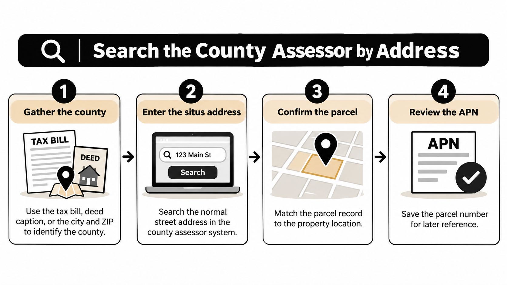
The Six-Step County Search
- Name the county, not just the city. Use the tax bill, the deed caption, or the city and ZIP to pin the county down. Some cities sit in more than one county, so searching the wrong assessor returns nothing or, worse, a same-named street elsewhere.
- Open that county's assessor, property tax, or GIS property search. Treasurer and tax collector sites sometimes host the same parcel lookup. Start from the county's official site, not a data scraper, so the number you copy is the roll number.
- Search the situs address, then retry mismatches. Try Street versus St, add or drop a directional prefix like North or West, include the unit number for a condo, and check whether a rural route was replaced by a road name. County records often keep an older format than the mailing address.
- Open the parcel detail and copy the APN exactly as displayed. Counties label the field differently, and a search box may want the APN without dashes even when the detail page prints them with dashes. Copy the displayed form first, then adapt it only if a form demands it.
- Confirm you've opened the right parcel. Match the owner name, situs, acreage or lot size, and the first lines of the legal description to the property you mean. Similar street numbers on the same road are a common miss, especially where house numbers repeat across an unincorporated area and a nearby city.
- Save the parcel report or map link and note the tax year shown. That date matters later if a split or merger changes the roll. A screenshot without a date can't prove what the county showed when you checked. For broader searching technique, public records property search methods cover how assessor, recorder, and court portals differ.
When Several Results Return
Don't pick the first row. Say a search for 1200 Oak returns three parcels because the house sits on one lot, a side yard sits on another, and a condo building down the road shares the base address. Compare the legal description, lot size, and owner on each detail page, then keep every APN that belongs to the property you're evaluating.
If the search returns nothing, stop. Don't guess digit patterns from a neighboring parcel, and don't borrow a number format from a deed in another county. A blank result usually means the address format differs, the parcel has no situs, or you're in the wrong county system. That's a signal to switch to the map, not to invent a number.
Find a Parcel When the Address Fails
A street address is a useful clue, not a universal starting point. Vacant land may have no situs address, new subdivisions may not have addresses assigned, and rural parcels may be easier to identify by roads and boundaries. Sierra County's parcel search guidance explains that some parcels must be found by APN or on a GIS map instead. A condominium's mailing address may also differ from the parcel's situs.
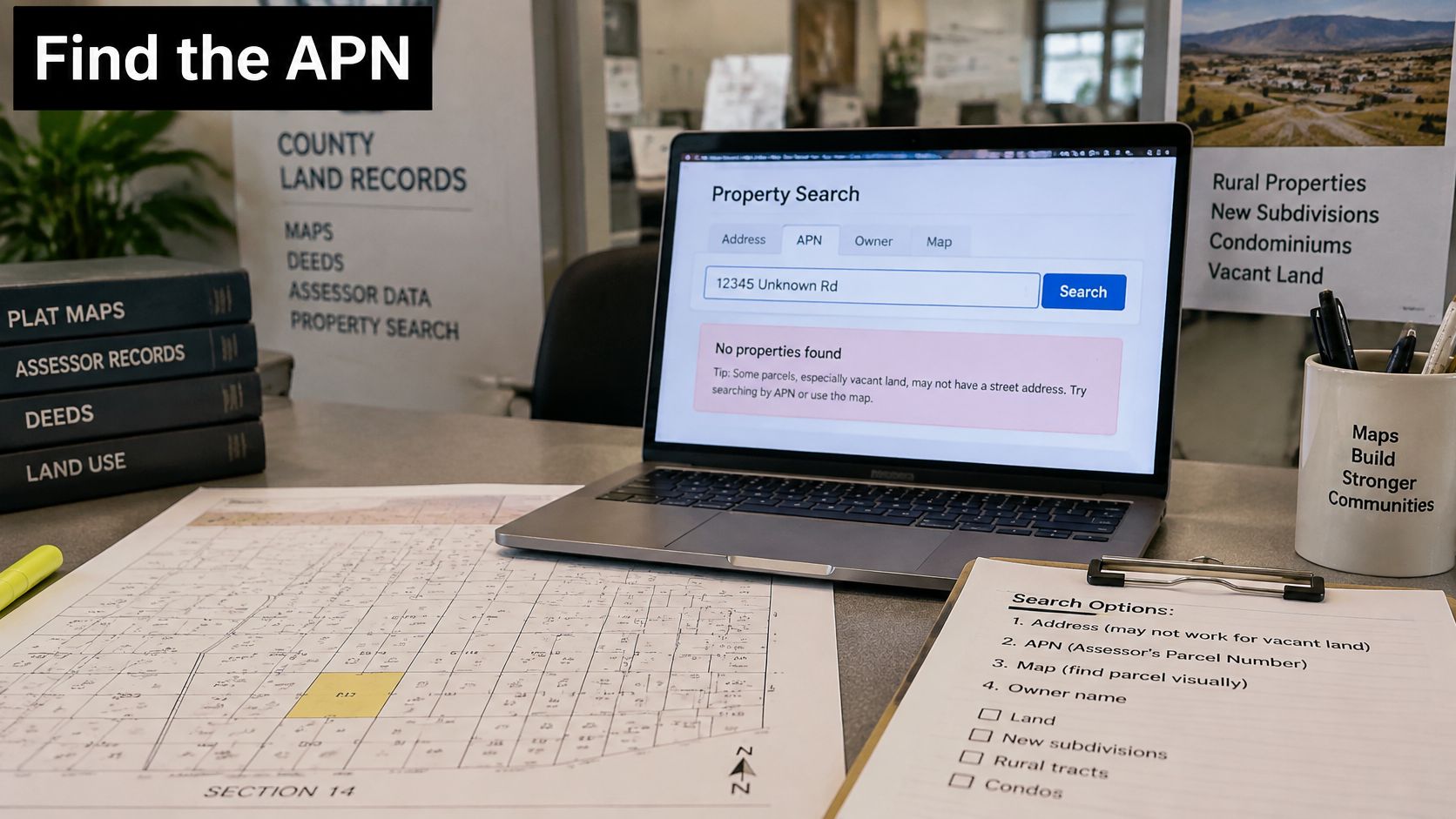
Work the Map, Not the Search Box
First identify the county, then open its assessor GIS parcel viewer. Use nearby named roads, section lines, or subdivision boundaries that you can confirm on the map. A developer's “Lot 7 at Sunset Ridge” may not appear in county records under that marketing name. The assessor may instead show a tract number and its lot lines.
Select candidate polygons individually and check the owner, acreage, and legal description shown in each pop-up. Compare those details with the deed's lot, block, tract, or metes-and-bounds description. The map shape and description should point to the same land. If you are showing buyers parcel boundaries from above, checking the polygon first helps avoid outlining the wrong lot.
If the parcel does not appear, contact the assessor with its legal description rather than guessing an APN. That description gives staff another way to search the roll. A guessed number could point to someone else's property.
Format Traps and Special Cases
APN formats vary by county, including their lengths and punctuation. Copy the format the county displays instead of adapting a pattern from another county. Some systems require dashes; others reject them. Do not pad a short number with zeros or remove punctuation that separates parts of the parcel number.
For a condominium, distinguish the unit parcel from the parent land or common-area parcel. They may carry different APNs and tax bills. A recently recorded split may not yet appear in the GIS layer, so compare the recorded tract map with the viewer and ask the assessor which parcel numbers have posted. If the property crosses a county line, check each county's records: each assessor handles the portion within its boundary, so the land may have two APNs.
When the address is ambiguous, locate the parcel on the map first. Use the address as a clue, then verify the candidate against the legal description and boundary lines.
Check Whether an Old APN Still Applies
An old APN on a deed or downloaded list may no longer identify a separate parcel. Using it in an offer can point to land that has since been divided, adjusted, or combined. For investors, lenders, and title researchers, the key is matching historic records to the parcel on the current tax roll.
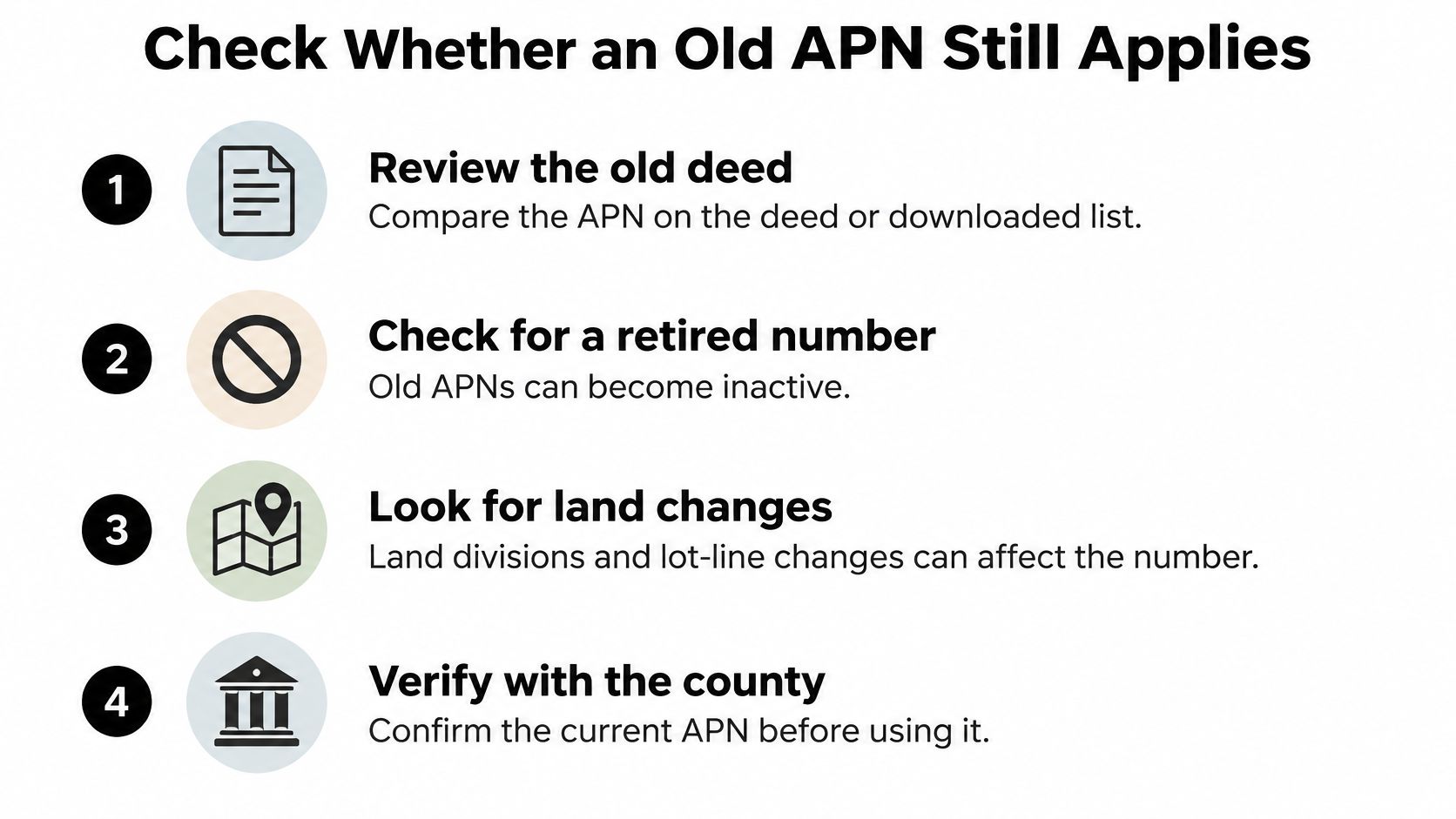
Sacramento County's assessor parcel maps FAQ explains that APNs can change after land divisions, lot-line adjustments, mergers, parcel combinations, and tax-rate-code changes. Changes generally take effect in the tax-roll year after completion. Counties may also assign a new APN when a parcel's shape or size changes, a parent parcel is split, or map books are reorganized. A changed APN does not necessarily mean taxes changed.
During the transition, a deed, tax bill, title report, GIS map, and assessor database may show different identifiers for related land. These records are dated snapshots. Compare their dates and descriptions to determine which identifier matches the current roll.
| Event | What happens to the APN | What to compare instead |
|---|---|---|
| Land division or split | Child parcels get new APNs; the parent number may retire | Tract map, lot lines, and new legal descriptions |
| Lot-line adjustment | The number may change with the parcel's new shape | Adjusted map and both owners' deeds |
| Merger or combination | Several APNs become one | Merger document and combined acreage |
| Map book reorganization | The same land may receive a new number | Old and new assessor maps side by side |
| Tax-rate-code change | Sacramento lists this as a reason an APN can change | Tax-roll year after completion and assessor confirmation |
| Sale with no map change | The APN usually stays the same; the owner name updates | Current tax roll and the deed date |
Proving Old and New Numbers Match
To check whether two APNs refer to the same land, compare the legal descriptions, parcel or tract maps, and any recorded split or merger documents. The situs address can help, but it is not enough by itself. Ask the assessor to confirm the match. Following the recorded documents is also part of building a chain of title, where each link must describe the same property.
Matching digits, a similar street number, or a shared owner surname does not prove that two records identify the same parcel. After a split, an old parent APN may no longer describe any individual lot. Use the current assessor APN in offers and loan files, and keep the older number only as a clearly labeled cross-reference.
Copy and Verify the APN Before You Offer
Start with your candidate number and check it before anything else leaves your desk. Keep the county's punctuation. A search box may accept a plain string while a lender form wants the dashed version, but dropping a leading zero points to a different parcel either way, so transcribe the number character by character from the assessor display.
Don't confuse the APN with a tax bill account number, a permit number, or the deed's book and page or instrument number. Those identifiers live near each other on the same paperwork, and they're not interchangeable. The APN identifies the land on the tax roll. The others identify a billing account, a job, or a recorded document.
Parcels Buyers Commonly Miscopy
- Condominium. Confirm you copied the unit parcel, not the underlying land, a common-area parcel, or a separately parceled parking space.
- House on two legal lots. List both APNs, since offering on one leaves part of the yard, and possibly part of the structure, out of the contract.
- Mailing address differs from situs. Trust the situs on the assessor record when the owner receives mail elsewhere, because the roll is organized around where the land sits.
Reject numbers sourced from blogs, a neighboring county's worked example, or an old screenshot once the roll shows a replacement. Those numbers may have been accurate when published, but they can't outrank the county that taxes the parcel today.
Run the Three-Way Test
Your APN passes when three records describe one property. The number on the current tax bill or assessor printout, the number on the GIS polygon you clicked, and the deed's legal description must all point to the same land. If any leg disagrees, call the assessor with the legal description before paying a deposit or ordering title.
Record the date you checked, since a split recorded this year may not reach the roll until the next tax year. That timing also affects closing paperwork, and buyers budgeting beyond the purchase price should review items like Florida closing costs with the correct parcel identified first, so tax prorations attach to the right land.
Before you sign: Quote the current APN, county, and situs with a printout dated that day, and list any retired number as a former APN so title can chain the legal description.
Once you've confirmed the current APN, county, and legal description, use PropLab to pull the property's public records and market signals into an underwriting report with ARV, rehab estimates, weighted comps, and a clear Max Offer Price. You'll get an offer-ready analysis you can export or share with partners and lenders, built on the right parcel from the start.
About the Author
P
PropLab Team
Real Estate Analysis Experts
The PropLab team consists of experienced real estate investors, data scientists, and software engineers dedicated to helping investors make smarter decisions with AI-powered analysis tools.
Free account
Underwrite your next deal in under a minute
3 free analyses, no credit card. ARV, rehab, comps and exit strategy in one report.
